Kimberley King Project
Multiple quartz veins along a 13 km corridor on a major north-trending fault — along strike from the historical Mount Synnot gold reef, with a coincident alteration footprint and the best stream gold in a 3,500 km² regional survey. Never sampled.
An untested gold structure in the west Kimberley
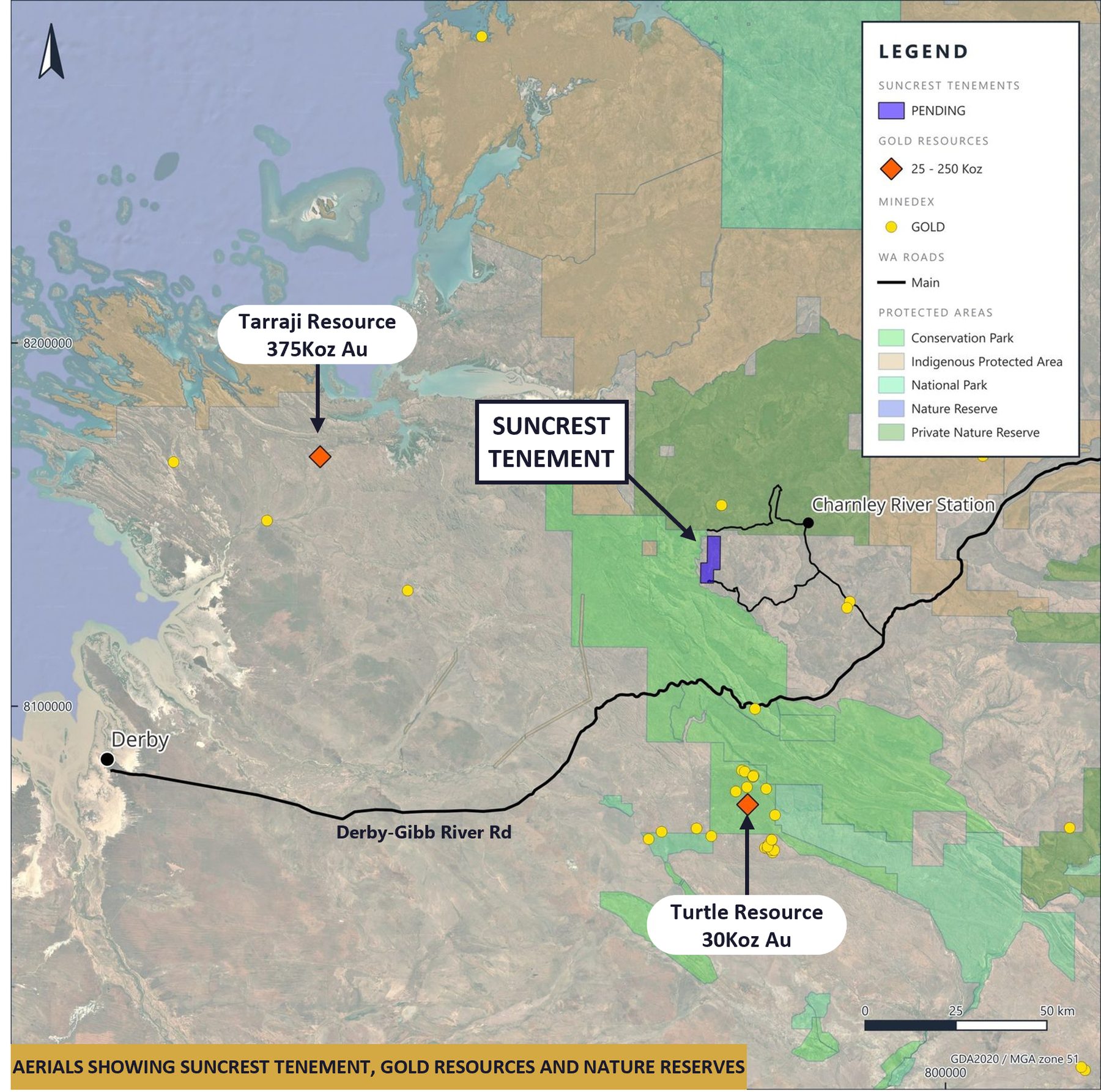
Kimberley King is a single exploration licence application (E04/2943) approximately 175 km east of Derby, with good access via the Gibb River Road and Charnley River Station tracks. The tenement lies outside all parks and reserves, on pastoral land.
A major north-trending fault mapped by the Geological Survey of Western Australia runs the full 13 km length of the tenement and continues north to the historical Mount Synnot gold occurrence, where pyritic quartz reef sampling in 1907 is reported to have returned 2 g/t Au and the reef was described as extending for at least 5.8 km. That occurrence lies outside the application in a private nature reserve and has never been followed up. GSWA notes the Kimberley Basin's potential to host epithermal gold of the style found at Oombulgurri.
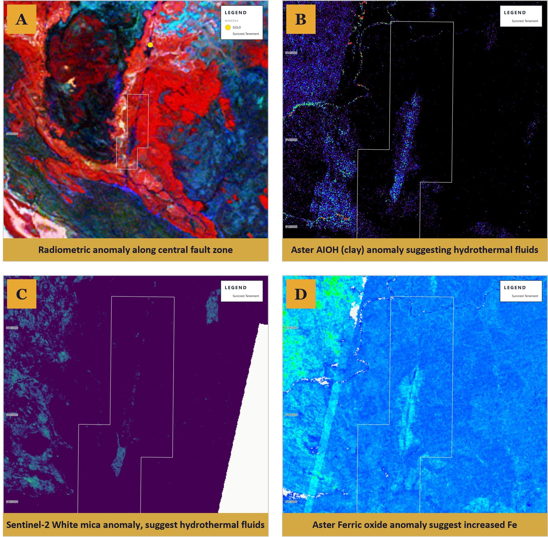
Four independent datasets light up the same 5 km of the fault
Airborne radiometrics show a sharp north-trending break the full length of the tenement — the Mount Synnot fault. ASTER clay (AlOH) and Sentinel-2 white-mica products define a ~5 km × 500 m alteration strip beside the interpreted veins, cutting across local drainage rather than following it, and ASTER ferric-oxide composition follows the same trend — consistent with weathered pyritic veins.
In basalt terrain, structurally aligned clay and sericite are the expected footprint of wall-rock alteration around a vein system. Radiometric break, clay, mica and iron oxide all coincide with the mapped fault and the veining seen from the air.
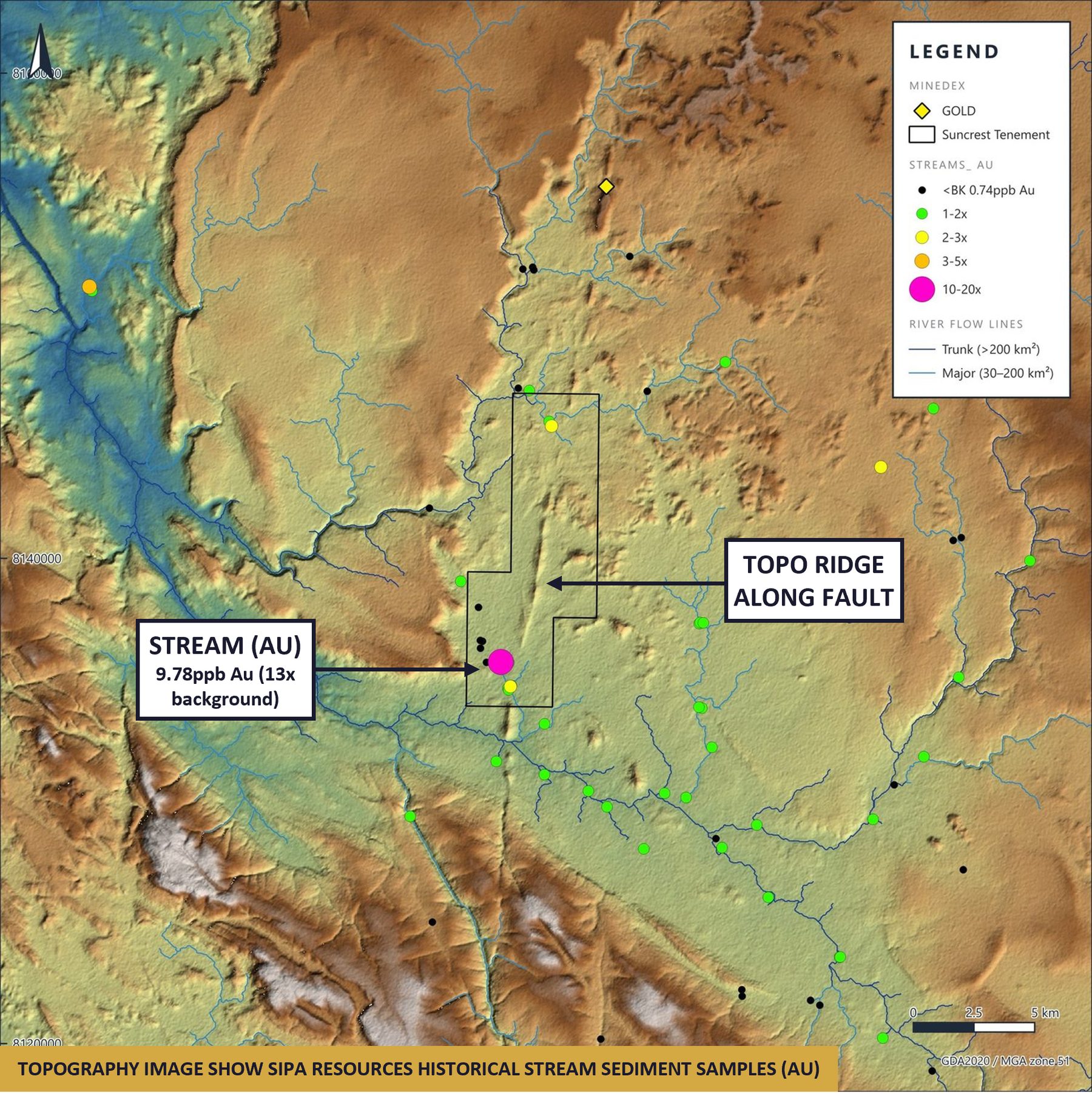
The best stream gold in a 3,500 km² survey sits on the tenement
Sipa Resources' 2007 regional stream-sediment survey (167 sites over ~3,500 km²) returned its highest gold value — 9.78 ppb Au, around 14× background — at a site on the tenement, confirmed by a resample. Every stream site on the tenement sits above the survey median, forming two coherent anomalies rather than a single sample.
All values are low-level, as expected for stream sediments; they are a first step in target definition, not a deposit. Sipa never sampled the vein system itself.
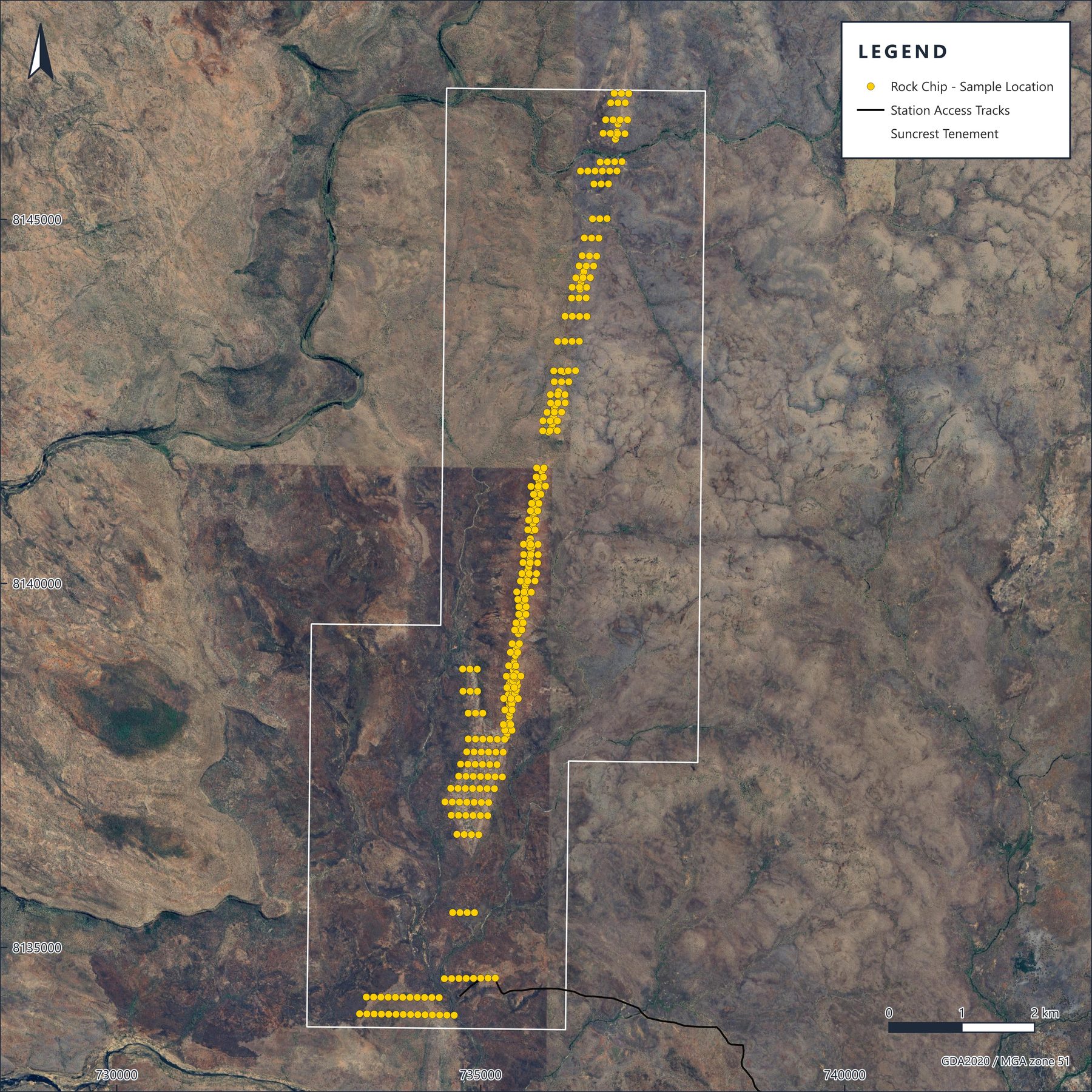
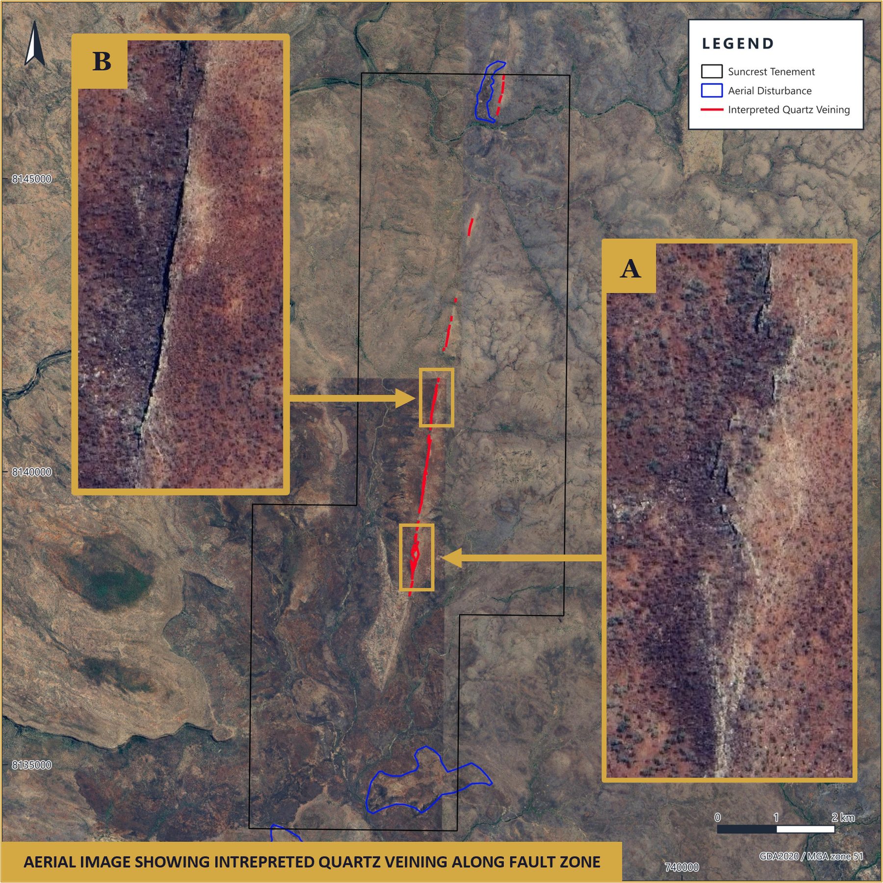
Multiple quartz veins traced along 13 km of the fault — visible from orbit, never sampled
High-resolution aerial imagery shows multiple outcropping quartz veins along the fault corridor for the full length of the tenement. The most continuous veining, in the south, coincides with the clay, mica and iron-oxide alteration and the stream-gold catchment.
Dilational jogs and en-echelon steps along the corridor mark the sites where vein thickness and grade concentrate in fault-hosted gold systems. Clusters of small pits at either end of the corridor are interpreted as historical prospecting activity, though this has not been confirmed.
Kimberley King targets
Access & heritage
Step 1Station consent and heritage clearance for the traverse lines ahead of the dry season (May–October). No clearing, no camps beyond the station, no ground disturbance beyond hand sampling.
Mapping & rock chips
Step 2Systematic rock-chip sampling of the quartz veins across the 13 km corridor, with detailed structural and alteration mapping and a ground check of the interpreted old workings.
Rank and target
Step 3Gold and multi-element assays (Ag, As, Sb, Bi, Cu, Pb, W, Te) rank the veins for follow-up sampling and a first drill program.
Next steps
Outcropping targets and station-track access mean Kimberley King can be tested quickly and at very low cost. Once the application is granted and heritage access is secured, a first-pass mapping and rock-chip program will test whether gold mineralisation extends along the fault system. The application has not yet been granted.