Dundas Project
A 10 km gold trend in calcrete and soil with a coincident copper signature — on the same crustal boundary that delivered Tropicana and Nova.
On a productive gold-nickel belt
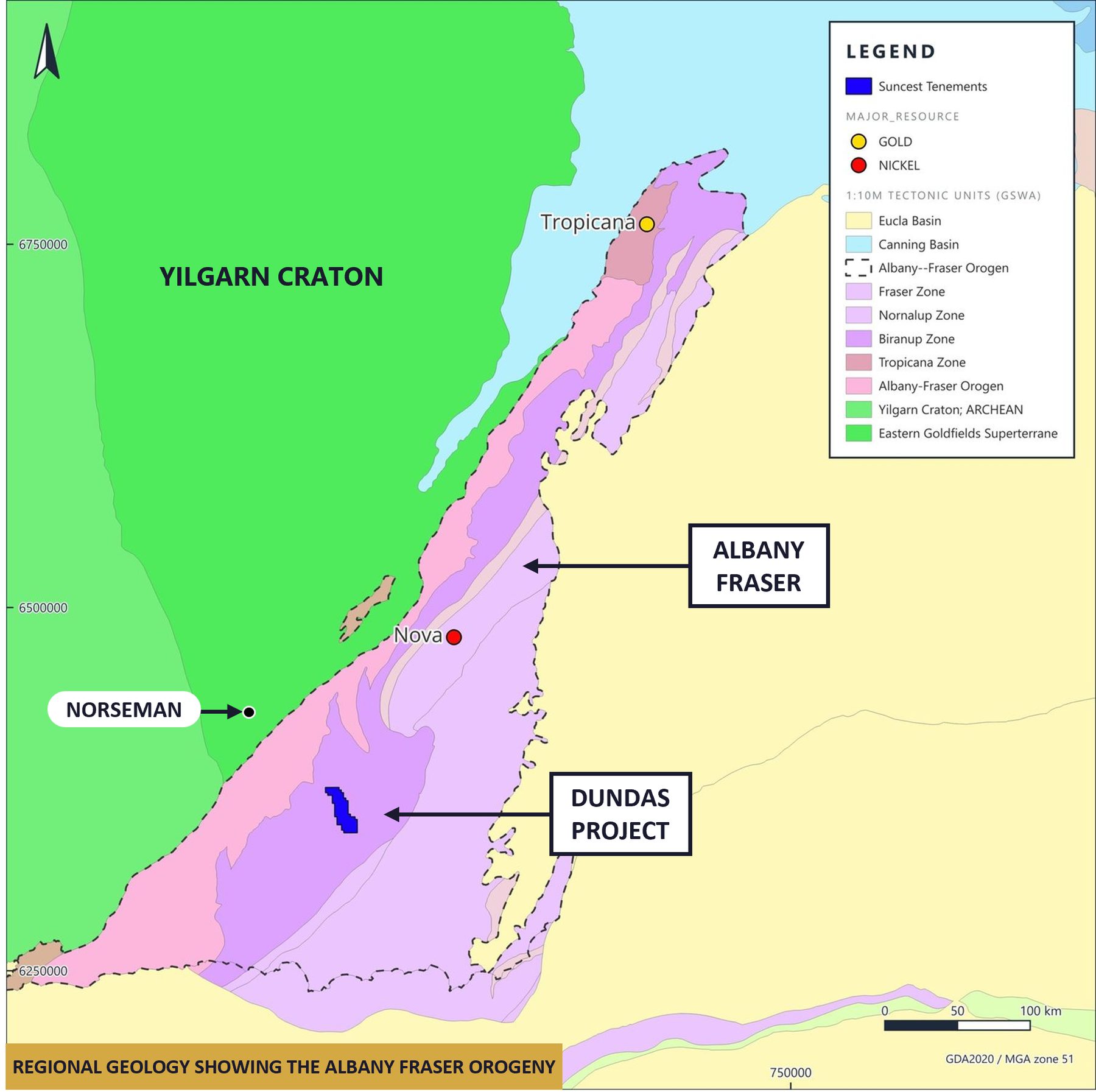
Dundas comprises two contiguous tenement applications on the southern Albany–Fraser Orogen, between Norseman and Esperance. The belt hosts AngloGold Ashanti's >12.89 Moz Tropicana gold deposit to the north and IGO's Nova-Bollinger nickel-copper mine, one of Australia's largest nickel-copper discoveries this century.
The project sits within the Biranup Domain, where reworked Archaean rocks transition into Paleoproterozoic basement — the same structural setting that hosts Tropicana. A heritage agreement with the Ngadju Native Title Aboriginal Corporation has been executed by Suncrest and awaits Ngadju co-signature. Active gold processing infrastructure operated by Pantoro Gold sits at Norseman, 75 km to the north-west.
Gold, copper and pathfinders over the same footprint
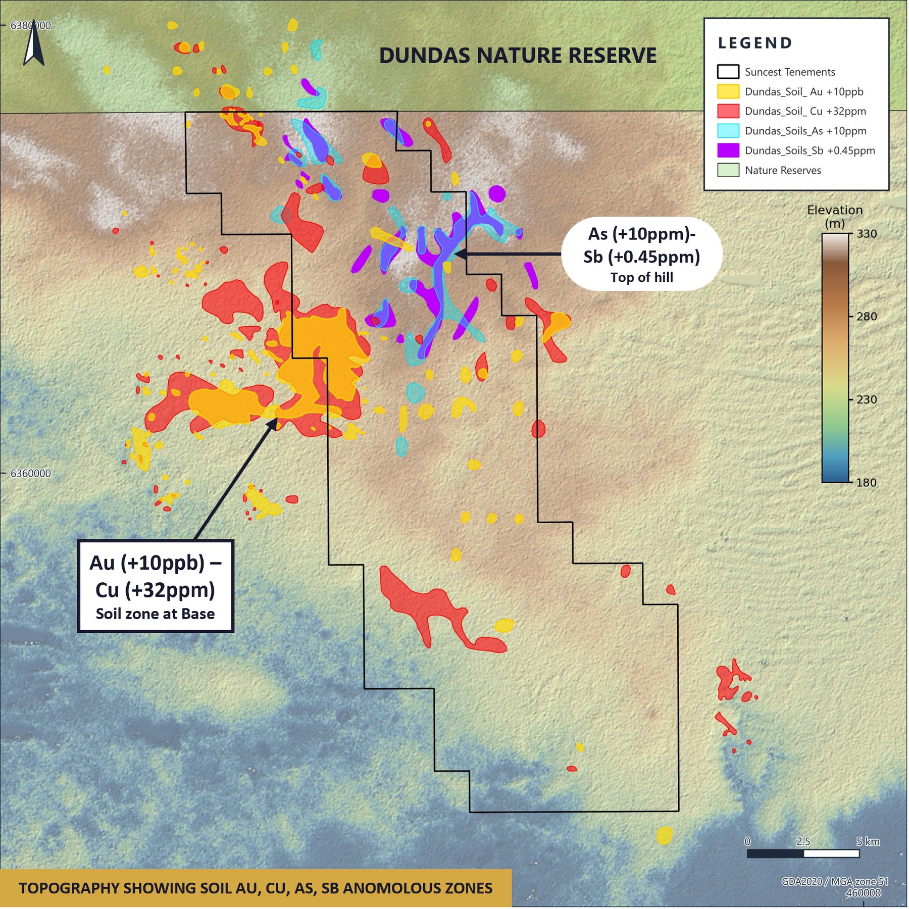
Historical sampling by Great Southern Gold in 2011 defined a coherent 10 km gold-in-soil anomaly (>10 ppb Au, peaks of 32 ppb against a 3.2 ppb regional background) with a coincident copper signature and a strong As–Sb–Pb pathfinder halo. The anomaly was never followed up.
Under the saline groundwater conditions typical of the belt, gold and copper are mobile and disperse into drainage, while the less-mobile pathfinders remain on the plateau crest 3–5 km up-slope — the interpreted source position. Together these patterns vector toward a large zoned magnetic intrusion at depth, suggesting an intrusion-related gold system.
Sparse historical drilling has already hit gold, copper and silver
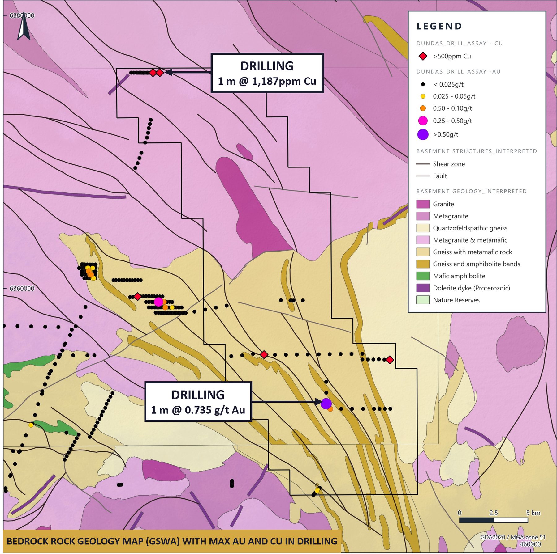
Of 963 holes compiled regionally, only 80 sit inside the tenements and none tests the anomaly core. In the northern block, Great Southern Gold returned 1 m @ 0.051 g/t Au from 33 m, with surrounding holes ending in elevated copper — peak 1 m @ 1,187 ppm Cu at end of hole. Heritage clearance delays limited follow-up at the time.
In the southern block, Rio Tinto — targeting mineral sands rather than gold — intersected a broad gold- and silver-rich zone with a peak of 1 m @ 0.735 g/t Au + 5.65 g/t Ag from 25 m, again at end of hole. No follow-up drilling has been completed.
Dundas targets
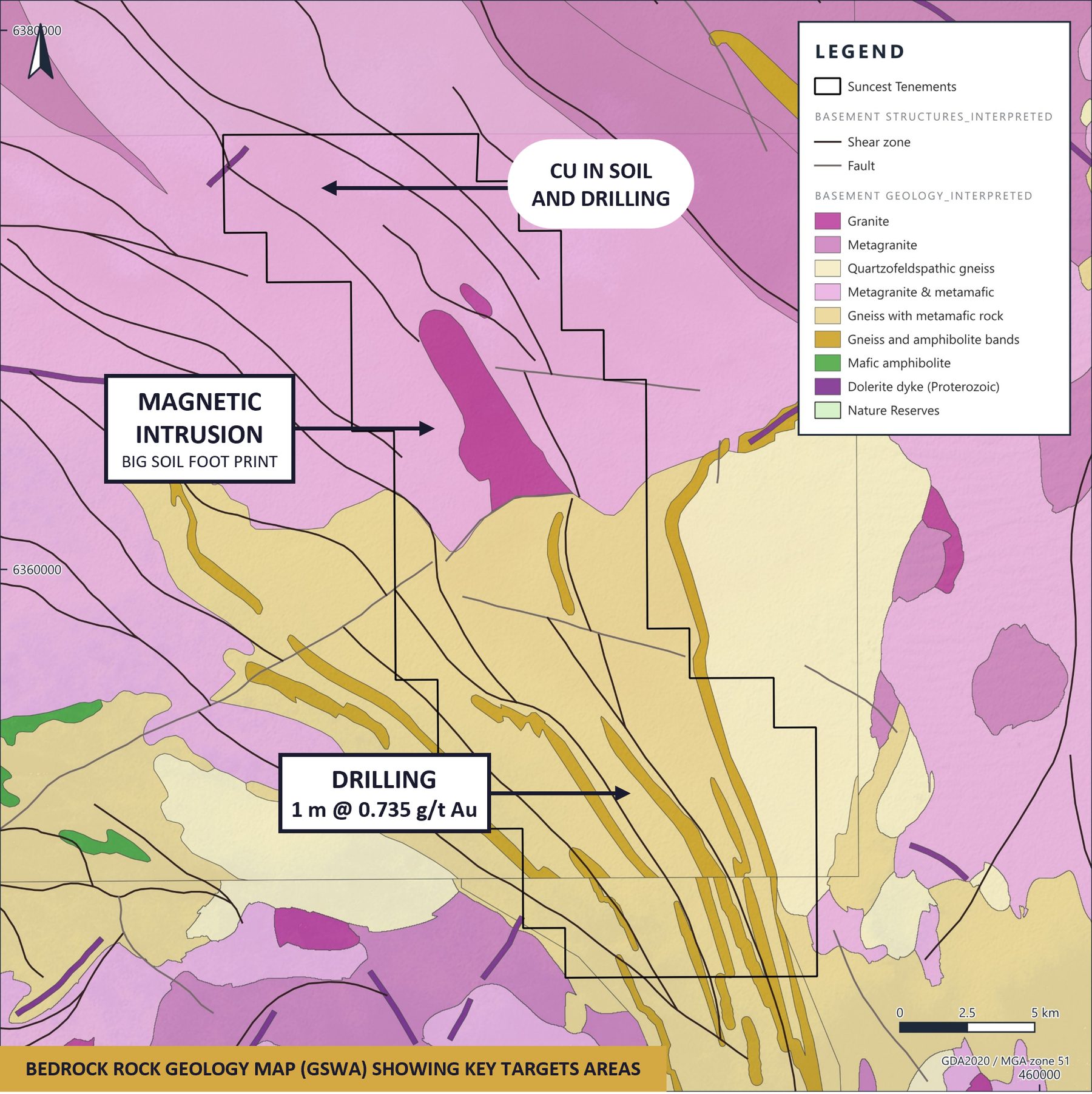
Magnetic intrusion
Highest priorityInterpreted source of the Au–Cu dispersion — a zoned intrusion beneath the pathfinder crest and the primary drill target.
Historical drill highs
High priorityThe southern Au–Ag intercept (1 m @ 0.735 g/t Au + 5.65 g/t Ag) was never followed up; no soils exist in this area. Infill lines planned.
Northern drilling
ModerateDrilling returned 1 m @ 1,187 ppm Cu with local Au–Cu–As–Sb soil footprints along a major structural flexure.
Next steps
Soils first, then success-based aircore: orientation soil sampling across the pathfinder crest and the Au–Cu zone at the base of slope will define the drill core, with aircore drilling on the intrusion target to follow, subject to heritage clearance with the Ngadju People.